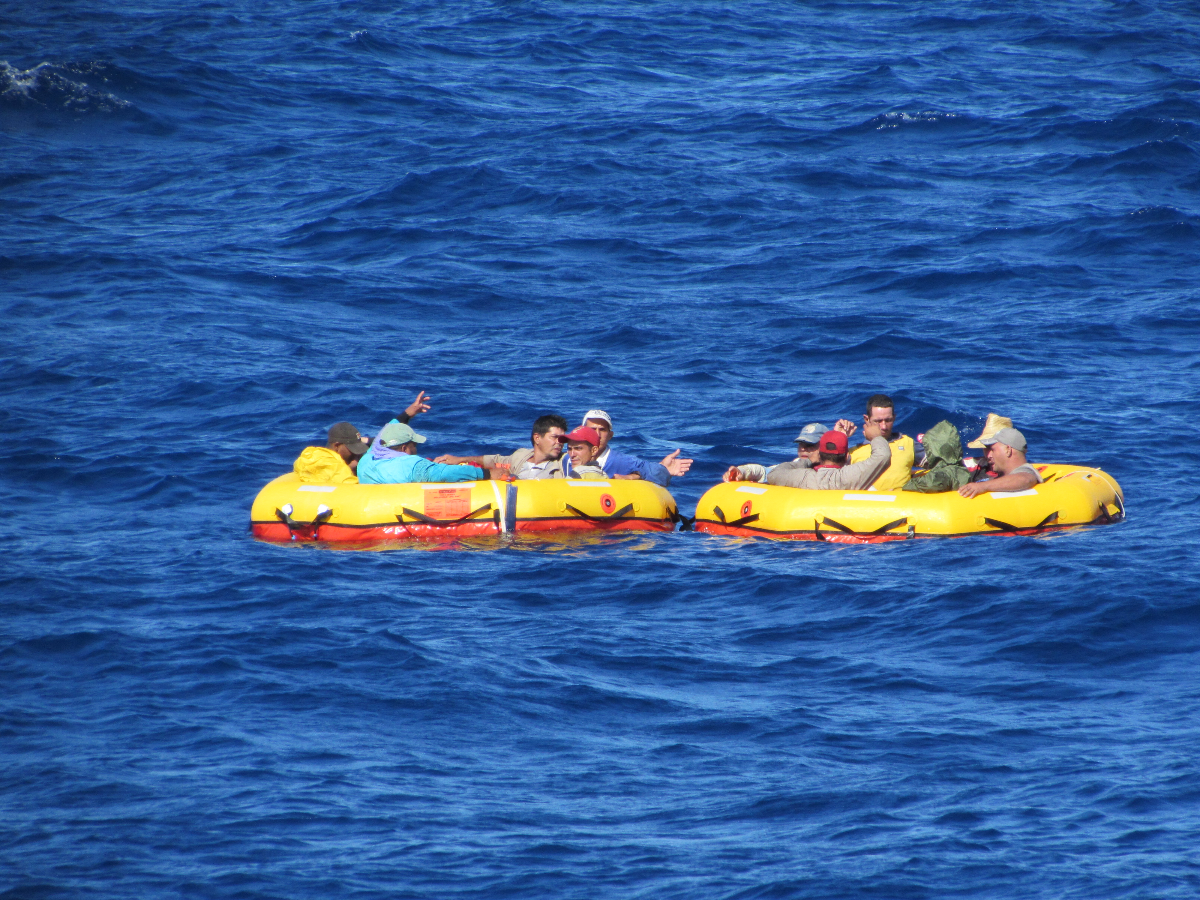
Twelve Cuban migrants drift aboard two life rafts provided by a Coast Guard aircraft that located the migrants aboard a partially submerged migrant vessel 100 miles southwest of Key West, Florida, Dec. 17, 2015. The migrants were subsequently rescued by the crew aboard the Coast Guard Cutter Isaac Mayo. (U.S. Coast Guard photo)
MIAMI — Crewmembers aboard the Coast Guard Cutter Isaac Mayo repatriated 58 Cuban migrants to Bahia de Cabañas, Cuba, Tuesday.
This repatriation is a result of five separate migrant interdictions at sea in the south Florida Straits. These events were Cubans trying to illegally enter the United States on unseaworthy vessels commonly called "rustics" or "chugs." In these instances the Coast Guard not only helped secure the U.S. border, but they also prevented these perilous ocean voyages from ending in tragedy.
One event highlights just how dangerous these migration attempts have become. On Dec. 17 a Coast Guard aircraft located an unseaworthy migrant vessel that was partially submerged with 12 people on board. The Coast Guard deployed two life rafts from the aircraft for the migrants to embark while their home-made vessel sunk nearly 100 miles southwest of Key West, Fl. The Coast Guard Cutter Isaac Mayo arrived on scene and rescued the 12 distressed migrants from the life rafts.
On the same day and within hours of the rescue of the 12 migrants from the life rafts, the Isaac Mayo interdicted three other vessels carrying 37 migrants. These vessels were also considered unseaworthy and the illegal voyages could have resulted in more tragic endings.
"Homemade vessels with no navigation or lifesaving equipment trying to cross these dangerous waters is a recipe for disaster. On this day, it is safe to say the Coast Guard and the Isaac Mayo crew saved 58 lives," said Cmdr. Tim Cronin, Coast Guard 7th District deputy chief of law enforcement. "There is a legal and safe way to enter the United States…this is not it. The Coast Guard’s priority in the Florida Straits is to protect people from the sea, but we also work hand in hand with our Customs and Border Protection to secure our borders from illegal entry."
Coast Guard Cutter Isaac Mayo is a 154-foot fast response cutter homeported in Key West.
Since Oct. 1, the Coast Guard 7th District estimates that 1,307 Cubans have attempted to illegally migrate via the sea. These numbers represent the total amount of at-sea interdictions, landings and disruptions in the Florida Straits, the Caribbean and Atlantic.