

SWC Forums
Pull up a chair...let's talk fishing.

I am currently working in Ft. Lauderdale and we will be evacuating Friday.

God Bless the USA!

I am currently working in Ft. Lauderdale and we will be evacuating Friday.
Larry, don't bring Irma with you!!!!
Be safe brother.
I am currently working in Ft. Lauderdale and we will be evacuating Friday.
Larry, don't bring Irma with you!!!!
Be safe brother.
Thanks! I will be.
This mornings forecast looks even worst for S Florida. I'd like to stay for the Hurricane parties but I have to be in DC Monday for a job. I have a crew working in S Florida and they will be evacuating until it passes. Hopefully the hotel fairs well. Its ocean front.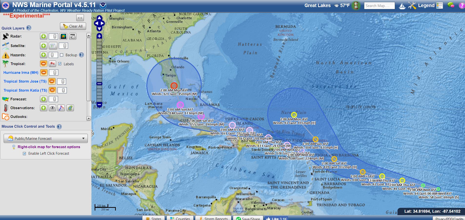
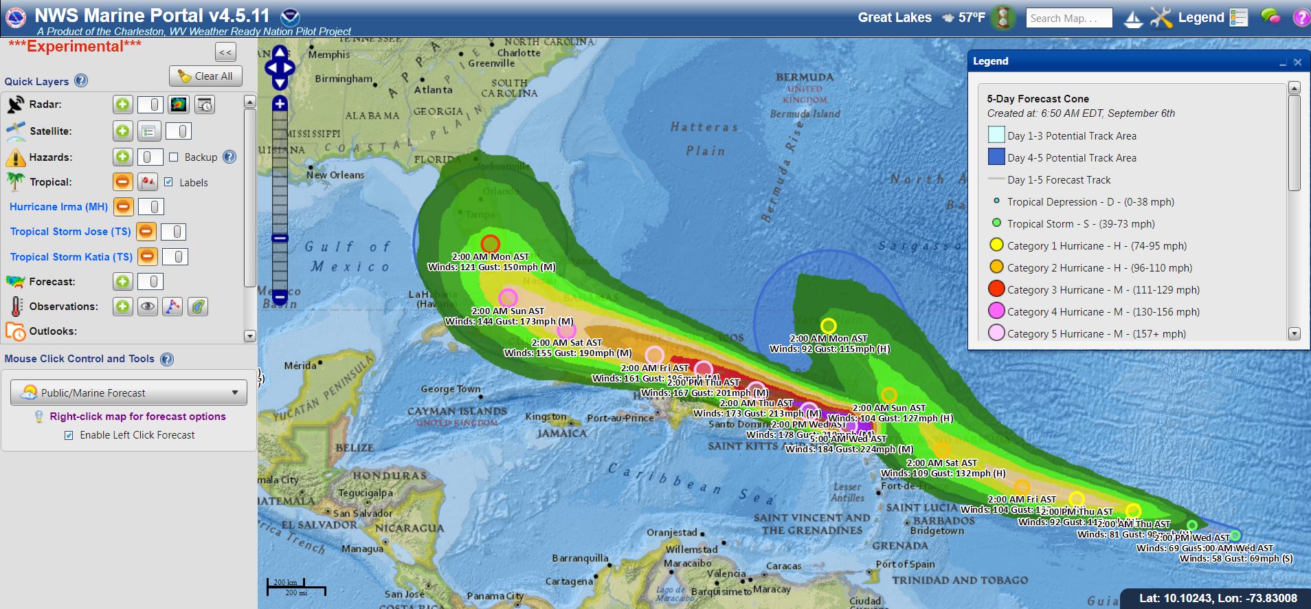
NC/SC might not be out of the woods yet. The two major models are now keeping the eye offshore or just a glancing blow with South Florida, then over the open ocean straight North into us. This one should not be taken for granted folks.
NC/SC might not be out of the woods yet. The two major models are now keeping the eye offshore or just a glancing blow with South Florida, then over the open ocean straight North into us. This one should not be taken for granted folks.
I agree with you. We certainly aren't out of the woods on this one yet. One little jog to starboard and we'll be looking down the barrel again.

NHC is being very cautious in changing its guidance, I think it's political, they don't want to say it's missing FL and have everyone relax and then change back again.
All the other major models have it turning early, skirting FL and tracking to either the SC/GA line or the NC/SC line for landfall.
Obviously if it follows the few models that show the more northerly track SENC takes the NE corner of the storm full on which would be devastating to us unless the shear from the trough that's steering it northward takes a lot of power from Irma.
48 hours will tell us a lot.
The latest from NWS Marine Portal. Not looking good for FL. We may have to leave earlier than expected...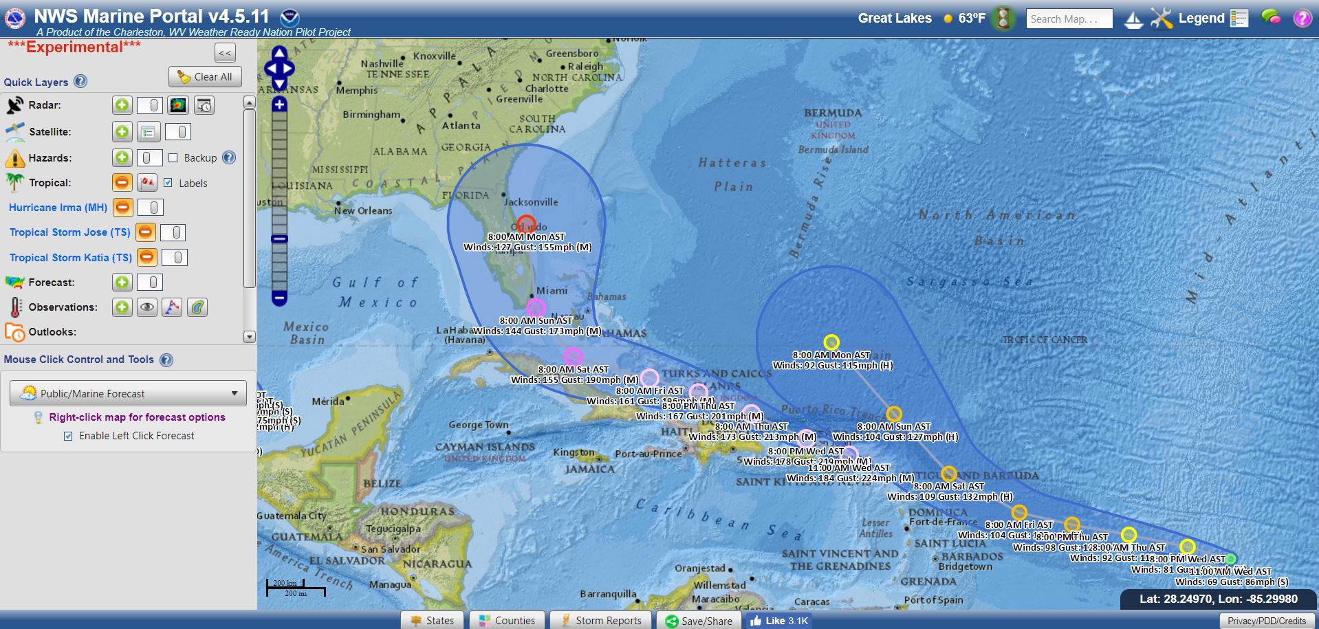
NHC is being very cautious in changing its guidance, I think it's political, they don't want to say it's missing FL and have everyone relax and then change back again.
All the other major models have it turning early, skirting FL and tracking to either the SC/GA line or the NC/SC line for landfall.
Obviously if it follows the few models that show the more northerly track SENC takes the NE corner of the storm full on which would be devastating to us unless the shear from the trough that's steering it northward takes a lot of power from Irma.
48 hours will tell us a lot.
The 5pm update will have new runs of the models incorporated,and I'm thinking the cone is going to move further east.
Sure wish I-140 was open all the way around.....and gas is already scarce.
Every hack politician and land developer that sabotaged the Cape Fear Skyway needs to stay their greedy asses behind until EVERYONE else gets out of town.

The latest from NWS Marine Portal. Not looking good for FL. We may have to leave earlier than expected...
Larry, y'all be safe down there.👍🏻👍🏻👍🏻
NHC is being very cautious in changing its guidance, I think it's political, they don't want to say it's missing FL and have everyone relax and then change back again.
All the other major models have it turning early, skirting FL and tracking to either the SC/GA line or the NC/SC line for landfall.
Obviously if it follows the few models that show the more northerly track SENC takes the NE corner of the storm full on which would be devastating to us unless the shear from the trough that's steering it northward takes a lot of power from Irma.
48 hours will tell us a lot.
The 5pm update will have new runs of the models incorporated,and I'm thinking the cone is going to move further east.
Sure wish I-140 was open all the way around.....and gas is already scarce.
Every hack politician and land developer that sabotaged the Cape Fear Skyway needs to stay their greedy asses behind until EVERYONE else gets out of town.
What I intended to post here is Jason is spot on with his comments on the skyway bridge. It is an absolute joke that it is not completed by now. They are building houses on some of the land that was intended for that bridge. How convenient.

Last update has Irma moving up the east coast of Fl and then it looks like SC or NC could be seriously impacted
Please pay attention to this one!
If anyone needs help, I am in Charlotte but am willing to drive and help where needed
Looking like a Hugo-like scenario now. Charleston is in the crosshairs, then Charlotte.

Looks like I'm driving down Friday afternoon and hauling the boat back home. Should have just done it Monday but was hoping this thing would go elsewhere.
Looks like I'm driving down Friday afternoon and hauling the boat back home. Should have just done it Monday but was hoping this thing would go elsewhere.
I debated on bringing mine back as well and like you, was hoping for a different turnout. My current situation...left yadkin county 30 minutes ago after a 9 hour work day to make the 5 hour journey to morehead to get the boat then turn right back around and head back to yadkin so i can be at work at 6 in the morning. Its going to be a looooong night